Home > Europe > United Kingdom > England > Birmingham > Area > Perry Beeches
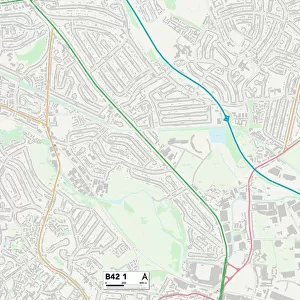
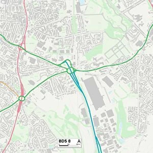
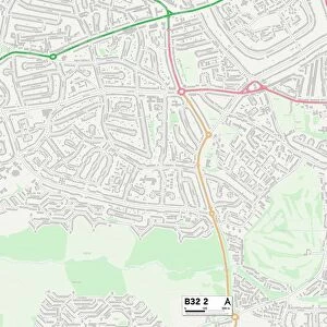
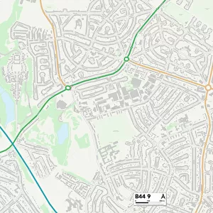
Birmingham B42 2 Map

![]()
Wall Art and Photo Gifts from Map Marketing
Birmingham B42 2 Map
Postcode Sector Map of Birmingham B42 2
Media ID 19964996
Ashworth Road Beacon Avenue Beeches Road Birmingham Castleton Road Chervil Close Church Road Deer Park Drive Edale Road Haddon Road Harris Drive Lindsay Road Longstone Road Mildenhall Road Perry Avenue Sandy Lane Scarsdale Road St Johns Walk Sterndale Road The Rise Thetford Road Thornbridge Avenue Tideswell Road Vicarage Close Wingfield Road
FEATURES IN THESE COLLECTIONS
> Arts
> Artists
> W
> John Wood
> Europe
> United Kingdom
> England
> Birmingham
> Area
> Beech Lanes
> Europe
> United Kingdom
> England
> Birmingham
> Area
> Perry Beeches
> Europe
> United Kingdom
> England
> Birmingham
> Area
> Queslett
> Map Marketing
> Postcode Sector Maps
> B - Birmingham
> Maps and Charts
> Related Images
MADE IN THE USA
Safe Shipping with 30 Day Money Back Guarantee
FREE PERSONALISATION*
We are proud to offer a range of customisation features including Personalised Captions, Color Filters and Picture Zoom Tools
SECURE PAYMENTS
We happily accept a wide range of payment options so you can pay for the things you need in the way that is most convenient for you
* Options may vary by product and licensing agreement. Zoomed Pictures can be adjusted in the Cart.