Home > Arts > Artists > H > Robert Hills
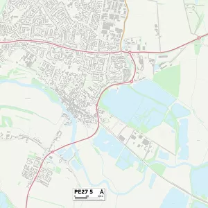
East Northamptonshire PE8 5 Map

![]()
Wall Art and Photo Gifts from Map Marketing
East Northamptonshire PE8 5 Map
Postcode Sector Map of East Northamptonshire PE8 5
Media ID 19977898
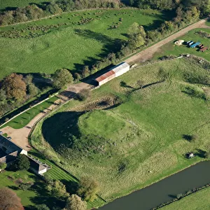
Ash View Ashton Barnwell Road Bridge Street Chapel End Church Green Church Hill Church Lane Church Row Church Street Coronation Crescent Duke Street East Northamptonshire Gibson Drive Gipsy Lane Glebe Court Gypsy Lane Highfields Laundry Road Lindsey Close Main Street Manor Farm Meadow Gate Mill Lane Moor End Oak Close Old Farm Lane Orchard Crescent Orchard Lane Oundle Road Rectory Lane Roberts Lane St Marys Close Station Road The Orchard The Paddock Well Lane Achurch Barnwell Fotheringhay Pilton Southwick St Marys Hill
FEATURES IN THESE COLLECTIONS
> Arts
> Artists
> H
> Robert Hills
> Europe
> United Kingdom
> England
> Northamptonshire
> Apethorpe
> Europe
> United Kingdom
> England
> Northamptonshire
> Ashton
> Europe
> United Kingdom
> England
> Northamptonshire
> Barnwell
> Europe
> United Kingdom
> England
> Northamptonshire
> Fotheringhay
> Europe
> United Kingdom
> England
> Northamptonshire
> Laxton
> Europe
> United Kingdom
> England
> Northamptonshire
> Lower End
> Europe
> United Kingdom
> England
> Northamptonshire
> Old
> Europe
> United Kingdom
> England
> Northamptonshire
> Oundle
> Europe
> United Kingdom
> England
> Northamptonshire
> Related Images
> Map Marketing
> Postcode Sector Maps
> PE - Peterborough
> Map Marketing
> UK Maps
MADE IN THE USA
Safe Shipping with 30 Day Money Back Guarantee
FREE PERSONALISATION*
We are proud to offer a range of customisation features including Personalised Captions, Color Filters and Picture Zoom Tools
SECURE PAYMENTS
We happily accept a wide range of payment options so you can pay for the things you need in the way that is most convenient for you
* Options may vary by product and licensing agreement. Zoomed Pictures can be adjusted in the Cart.