Home > Arts > Artists > B > Jan Blaeu
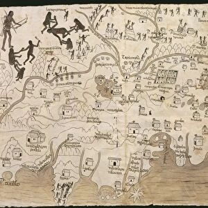
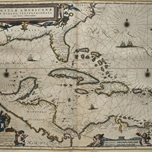
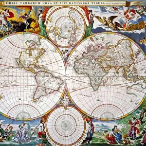
Atlas Novus, 17th c Map of Mexico

![]()
Wall Art and Photo Gifts from Mary Evans Picture Library
Atlas Novus, 17th c Map of Mexico
BLAEU, Jan (1596-1673). Atlas Novus or Atlas Maior. 1635 - 1665. Nova Hispania et Nova Galicia. Map of the viceroyalty of Spain and New Mexico. Printed in Amsterdam in 1645. Etching. SPAIN. CATALONIA. Barcelona. Biblioteca de Catalunya (National Library of Catalonia)
Mary Evans Picture Library makes available wonderful images created for people to enjoy over the centuries
Media ID 14179452
© Iberfoto/Mary Evans
1571 1596 1635 1638 1645 1665 1673 Amsterdam Atlas Barcelona Biblioteca Blaeu Catalonia Catalunya Engravings Etching Etchings Galicia Hispania Jalisco Janszoon Maior Mejico Mexican Mexicans Mexico Monde Nova Novus Viceroyalty Willem Zacatecas Nayarit
FEATURES IN THESE COLLECTIONS
> Arts
> Artists
> B
> Jan Blaeu
> Arts
> Artists
> B
> Willem Blaeu
> Europe
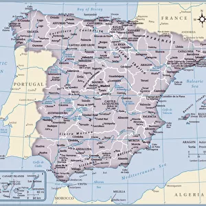
> Spain
> Related Images
> Historic
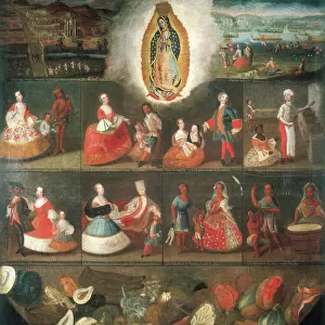
> Colonial America illustrations
> Colonial America
> Maps and Charts
> Related Images
> Maps and Charts
> Spain
> Maps and Charts
> Willem Janszoon Blaeu
EDITORS COMMENTS
This stunning 17th century map, titled "Nova Hispania et Nova Galicia" from the Atlas Novus or Atlas Maior by Jan Blaeu, offers a captivating glimpse into the cartographic knowledge of the New World during the Spanish colonial era. Printed in Amsterdam in 1645, this etching was produced by the renowned cartographer Willem Janszoon, also known as Guillermo Juan in the Spanish colonies. The map covers the vast territories of Mexico and New Galicia, which encompass present-day Mexico, the southwestern United States, and parts of Central America. Detailed and meticulously crafted, the map showcases the extensive geographical knowledge of the Spanish colonies at the time. It includes the names of numerous cities, rivers, mountains, and provinces, such as Mexico City, Veracruz, Jalisco, Nayarit, Zacatecas, and Tepic. The map also features intricate illustrations of indigenous peoples, their settlements, and various natural resources. The Atlas Novus was a significant achievement in cartography during the early modern period, representing the state-of-the-art knowledge of the world at the time. This particular map, housed in the Biblioteca de Catalunya (National Library of Catalonia) in Barcelona, Spain, is a testament to the rich history of cartographic exploration and the enduring fascination with the New World. Jan Blaeu, born in 1596 in the Netherlands, was a prominent cartographer, publisher, and engraver, who played a crucial role in the development of the Atlas Maior project. He continued the work of his father, Willem Blaeu, and expanded the family's cartographic enterprise, which became a leading source of geographical knowledge in Europe. The Atlas Maior, published between 1635 and 1665, was a monumental achievement, consisting of 62 maps and 22 supplementary charts, making it one of the most comprehensive atlases of the early modern period.
MADE IN THE USA
Safe Shipping with 30 Day Money Back Guarantee
FREE PERSONALISATION*
We are proud to offer a range of customisation features including Personalised Captions, Color Filters and Picture Zoom Tools
SECURE PAYMENTS
We happily accept a wide range of payment options so you can pay for the things you need in the way that is most convenient for you
* Options may vary by product and licensing agreement. Zoomed Pictures can be adjusted in the Cart.