Home > Europe > France > Paris > Maps
Map of Paris

![]()
Wall Art and Photo Gifts from Mary Evans Picture Library
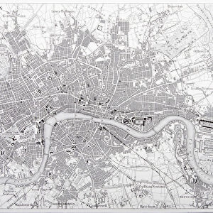
Map of Paris
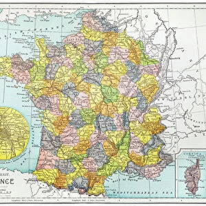
Bradshaws Plan of Paris, France and map of the environs Date: 19th century
Mary Evans Picture Library makes available wonderful images created for people to enjoy over the centuries
Media ID 7403555
© Mary Evans Picture Library 2015 - https://copyrighthub.org/s0/hub1/creation/maryevans/MaryEvansPictureID/10474578
FEATURES IN THESE COLLECTIONS
> Europe
> France
> Paris
> Maps
> Europe
> France
> Paris
> Related Images
> Maps and Charts
> Related Images
> Mary Evans Prints Online
> National Archives
EDITORS COMMENTS
This stunning 19th century map print, titled 'Bradshaw's Plan of Paris, France and map of the environs,' offers a captivating glimpse into the urban landscape of Paris during a bygone era. The intricate details of the map reveal the city's well-planned streets, historic landmarks, and expansive green spaces. The map's vibrant colors and meticulous labeling provide a wealth of information for both historical and contemporary contexts. The map was created during the 19th century, a time of significant growth and transformation for Paris. The city was undergoing a major expansion, with the construction of new boulevards, parks, and monumental buildings. The map reflects this period of urban development, showcasing the city's expanding borders and the addition of new neighborhoods. The map also highlights some of Paris' most famous landmarks, including the Louvre Museum, Notre-Dame Cathedral, and the Palace of Versailles. These iconic structures are depicted with great accuracy, providing a sense of the city's rich cultural heritage. The map's title, 'Bradshaw's Plan,' refers to George Bradshaw, a prominent British cartographer and publisher who produced a series of comprehensive maps and guides for travelers in the 19th century. Bradshaw's maps were renowned for their accuracy and detail, making them an essential resource for travelers exploring Europe and beyond. This map print is not only a valuable historical document but also a beautiful work of art. The intricate details and vibrant colors bring the city of Paris to life, transporting viewers to a bygone era. Whether used for research, decoration, or simply for personal enjoyment, this map print is a must-have for anyone with an interest in Parisian history or cartography.
MADE IN THE USA
Safe Shipping with 30 Day Money Back Guarantee
FREE PERSONALISATION*
We are proud to offer a range of customisation features including Personalised Captions, Color Filters and Picture Zoom Tools
SECURE PAYMENTS
We happily accept a wide range of payment options so you can pay for the things you need in the way that is most convenient for you
* Options may vary by product and licensing agreement. Zoomed Pictures can be adjusted in the Cart.