Home > Europe > United Kingdom > England > London > Sights > Golders Hill Park
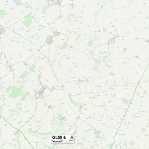
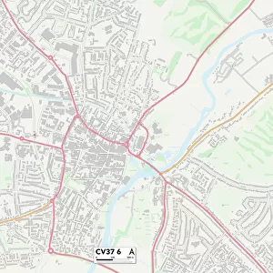
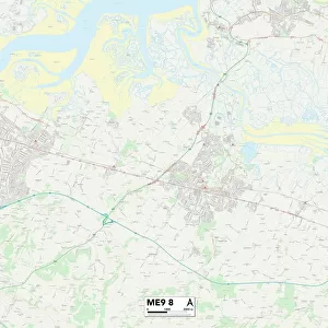
Tonbridge and Malling ME19 4 Map

![]()
Wall Art and Photo Gifts from Map Marketing
Tonbridge and Malling ME19 4 Map
Postcode Sector Map of Tonbridge and Malling ME19 4
Media ID 19974878
Admiral Way Alton Avenue Anson Avenue Ashton Way Beacon Avenue Beech Road Blenheim Road Bramley Way Carlton Close Chestnut Close Crabtree Close Discovery Drive Eden Way Elan Close Forest Way Garden Way Gibson Drive Holly Way Jubilee Way Kings Hill Lambourne Drive Lancaster Way Lysander Road Melrose Avenue Milton Lane Mitchell Road Northdown Close Peregrine Road Phoenix Way Queen Street Richmond Avenue Russet Way Saxon Close Spencer Place Spitfire Road Stirling Road Tempest Road Tonbridge And Malling Tower View Victoria Drive Warwick Way Wellington Way Windsor Road Winston Avenue Worcester Avenue Rougemont
FEATURES IN THESE COLLECTIONS
> Architecture
> Towers
> Victoria Tower
> Arts
> Artists
> A
> Francis Alexander
> Arts
> Artists
> P
> Francis Place
> Arts
> Artists
> Q
> Queen Victoria Queen Victoria
> Arts
> Landscape paintings
> Forest and woodland scenes
> Forest artwork
> Europe
> United Kingdom
> England
> London
> Politics
> Winston Churchill
> Europe
> United Kingdom
> England
> London
> Sights
> Golders Hill Park
> Europe
> United Kingdom
> England
> London
> Sights
> Regents Park
> Europe
> United Kingdom
> England
> London
> Sights
> Richmond Park
> Europe
> United Kingdom
> England
> London
> Sights
> Victoria Park
> Map Marketing
> Postcode Sector Maps
> ME - Rochester
MADE IN THE USA
Safe Shipping with 30 Day Money Back Guarantee
FREE PERSONALISATION*
We are proud to offer a range of customisation features including Personalised Captions, Color Filters and Picture Zoom Tools
SECURE PAYMENTS
We happily accept a wide range of payment options so you can pay for the things you need in the way that is most convenient for you
* Options may vary by product and licensing agreement. Zoomed Pictures can be adjusted in the Cart.