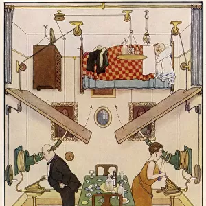
Home > Animals > Mammals > Muridae > Heath Mouse
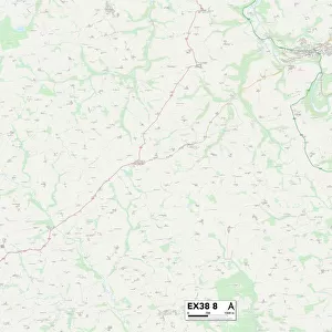
Exeter EX19 8 Map

![]()
Wall Art and Photo Gifts from Map Marketing
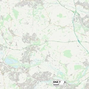
Exeter EX19 8 Map
Postcode Sector Map of Exeter EX19 8
Media ID 19969949
Ash Lane Barfield Road Bond Street Brook Road Castle Street Chapel Street Church Hill Church Lane Church Street Coopers Hill Down Lane Exeter Exeter Road Fore Street Forge End Green Lane Heath Lane High Street Lower Town Moorview Close Mucky Lane North Street Old Barn Close Orchard Gate Park Lane Park View Popes Lane Queen Street Rectory Road Shute Lane South Street Southernhay Stafford Road The Paddocks Torrington Road Upcott Vine Street Ward Lane West Lane West Road Whitehouse Lane Iddesleigh
FEATURES IN THESE COLLECTIONS
> Animals
> Mammals
> Muridae
> Heath Mouse
> Map Marketing
> Postcode Sector Maps
> EX - Exeter
> Maps and Charts
> Related Images
MADE IN THE USA
Safe Shipping with 30 Day Money Back Guarantee
FREE PERSONALISATION*
We are proud to offer a range of customisation features including Personalised Captions, Color Filters and Picture Zoom Tools
SECURE PAYMENTS
We happily accept a wide range of payment options so you can pay for the things you need in the way that is most convenient for you
* Options may vary by product and licensing agreement. Zoomed Pictures can be adjusted in the Cart.