Home > Arts > Street art graffiti > Digital art > Vector illustrations
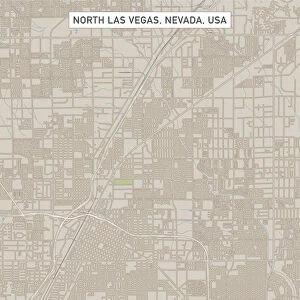
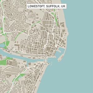
Las Vegas Nevada US City Street Map

![]()
Wall Art and Photo Gifts from Fine Art Storehouse
Las Vegas Nevada US City Street Map
Vector Illustration of a City Street Map of Las Vegas, Nevada, USA. Scale 1:60, 000.
All source data is in the public domain.
U.S. Geological Survey, US Topo
Used Layers:
USGS The National Map: National Hydrography Dataset (NHD)
USGS The National Map: National Transportation Dataset (NTD)
Unleash your creativity and transform your space into a visual masterpiece!
Frank Ramspott
Media ID 15055033
© Frank Ramspott, all rights reserved
Aerial View City Map Computer Graphic Directly Above Downtown District Gray Las Vegas Nevada Road Map Text Digitally Generated Image White Color
FEATURES IN THESE COLLECTIONS
> Aerial Photography
> Related Images
> Arts
> Contemporary art
> Digital artwork
> Street art
> Arts
> Landscape paintings
> Waterfall and river artworks
> River artworks
> Arts
> Portraits
> Pop art gallery
> Street art portraits
> Arts
> Street art graffiti
> Digital art
> Digital paintings
> Arts
> Street art graffiti
> Digital art
> Vector illustrations
> Fine Art Storehouse
> Map
> Street Maps
> Fine Art Storehouse
> Map
> USA Maps
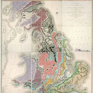
> Maps and Charts
> Geological Map
> Maps and Charts
> Related Images
> North America
> United States of America
> Maps
> North America
> United States of America
> Nevada
> Las Vegas
EDITORS COMMENTS
This print showcases a meticulously detailed city street map of the vibrant Las Vegas, Nevada. With its vector illustration and scale of 1:60,000, this artwork offers an immersive view of the bustling downtown district, complete with its iconic river and intricate network of streets. The map is based on reliable data from trusted sources such as the U. S. Geological Survey's National Hydrography Dataset (NHD) and National Transportation Dataset (NTD), ensuring accuracy and authenticity. The digitally generated image features a striking blend of colors, predominantly gray, blue, and white hues that beautifully depict the physical geography of this renowned city. From an aerial perspective directly above Las Vegas, viewers can appreciate the impressive cartography design that captures every road and pathway in exquisite detail. With no people present in the image, all attention is drawn to this stunning piece of art itself. Created by Frank Ramspott using publicly available source data from USGS The National Map series under non-commercial use terms; it represents a remarkable fusion between technology and creativity. Whether you are a resident or visitor to Las Vegas or simply captivated by urban landscapes brought to life through computer graphics, this print will undoubtedly make for an eye-catching addition to any space.
MADE IN THE USA
Safe Shipping with 30 Day Money Back Guarantee
FREE PERSONALISATION*
We are proud to offer a range of customisation features including Personalised Captions, Color Filters and Picture Zoom Tools
SECURE PAYMENTS
We happily accept a wide range of payment options so you can pay for the things you need in the way that is most convenient for you
* Options may vary by product and licensing agreement. Zoomed Pictures can be adjusted in the Cart.