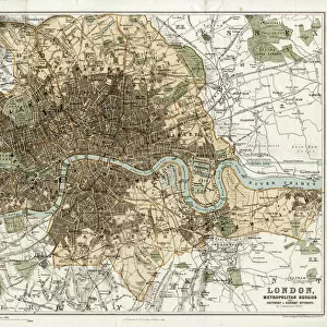
Home > Europe > United Kingdom > Scotland > Dumfries and Galloway > Thornhill
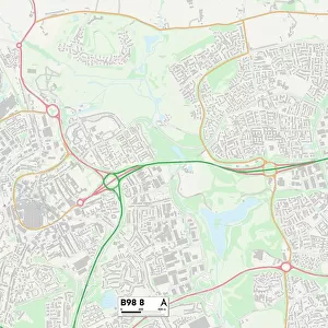
Redditch B98 9 Map

![]()
Wall Art and Photo Gifts from Map Marketing
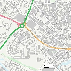
Redditch B98 9 Map
Postcode Sector Map of Redditch B98 9
Media ID 19965594
Acton Close Alcester Road Arley Close Barnwood Close Broad Lane Chapel Lane Church Hill Deans Close Deerhurst Close Eagle Road Fairford Close Flanders Close Greystone Close Jersey Close Knowle Close Loxley Close Madeley Road Moss Lane Naseby Close Northfield Close Oakridge Close Palmers Road Redditch Sandhurst Close Tanhouse Lane The Glebe Thornhill Road Woodgate Close
FEATURES IN THESE COLLECTIONS
> Animals
> Birds
> Accipitriformes
> Accipitridae
> Black Eagle
> Animals
> Mammals
> Muridae
> Heath Mouse
> Europe
> United Kingdom
> Scotland
> Dumfries and Galloway
> Thornhill
> Map Marketing
> Postcode Sector Maps
> B - Birmingham
> Maps and Charts
> Related Images
> Popular Themes
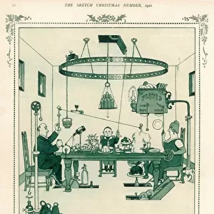
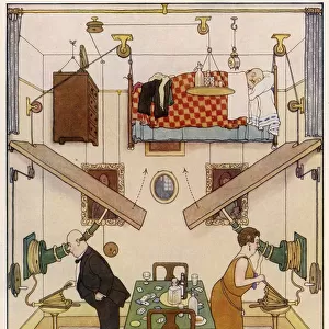
> Heath Robinson
MADE IN THE USA
Safe Shipping with 30 Day Money Back Guarantee
FREE PERSONALISATION*
We are proud to offer a range of customisation features including Personalised Captions, Color Filters and Picture Zoom Tools
SECURE PAYMENTS
We happily accept a wide range of payment options so you can pay for the things you need in the way that is most convenient for you
* Options may vary by product and licensing agreement. Zoomed Pictures can be adjusted in the Cart.