Home > Maps and Charts > World
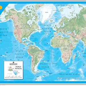
Giant World Map

![]()
Wall Art and Photo Gifts from Map Marketing
Giant World Map
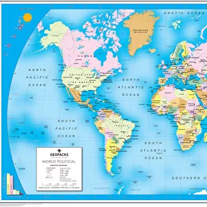
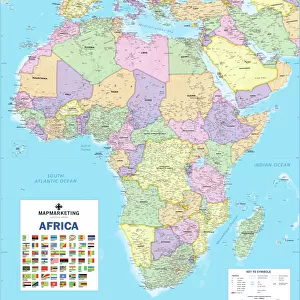
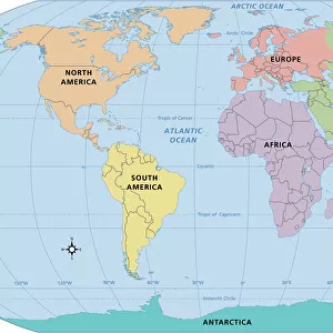
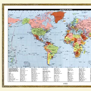
This extra-large map of the world is based on the Mercator Projection and is ideal for both business and educational purposes, or even simply as a stunning wall display. The exceptionally clear format shows political boundaries with each country depicted in a different vibrant colour to its immediate neighbours. The world map is further enhanced by coloured relief and ocean depth depictions, thus adding a striking textured effect and providing an element of physical representation to this political map. International time zones are depicted along the bottom of the map. Cities are depicted in five population bands, and the map also shows principal roads and railways, international boundaries (indicating those which are disputed) as well as state boundaries within countries. Capital cities of both countries and states are displayed, and international airports and seaports are shown
Media ID 19949308
© Map Marketing Ltd
FEATURES IN THESE COLLECTIONS
> Maps and Charts
> Popular Maps
> Maps and Charts
> Related Images
> Maps and Charts
> World
> Popular Themes
> Railway Posters
MADE IN THE USA
Safe Shipping with 30 Day Money Back Guarantee
FREE PERSONALISATION*
We are proud to offer a range of customisation features including Personalised Captions, Color Filters and Picture Zoom Tools
SECURE PAYMENTS
We happily accept a wide range of payment options so you can pay for the things you need in the way that is most convenient for you
* Options may vary by product and licensing agreement. Zoomed Pictures can be adjusted in the Cart.