Home > Europe > United Kingdom > England > Oxfordshire > Moreton
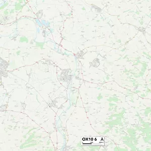
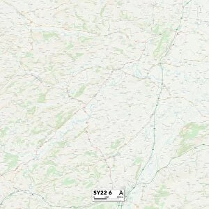
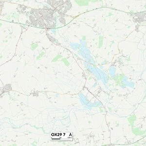
West Oxfordshire OX29 7 Map

![]()
Wall Art and Photo Gifts from Map Marketing
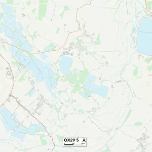
West Oxfordshire OX29 7 Map
Postcode Sector Map of West Oxfordshire OX29 7
Media ID 19978484
Abingdon Road Aston Road Back Lane Bampton Road Bartholomew Close Chapel Lane Church End Church Street Croft Lane Downs Road Hardwick High Street Lincoln Close Lovell Close Main Road Malthouse Lane Manor Crescent Manor Road Martins Lane Mill Meadow Moreton Lane Park Road Peel Close Pound Close The Butts The Downs The Furlong The Glebe The Orchard The Square Well Lane West Oxfordshire Witney Road Woodlands
FEATURES IN THESE COLLECTIONS
> Europe
> United Kingdom
> England
> Oxfordshire
> Abingdon
> Europe
> United Kingdom
> England
> Oxfordshire
> Aston
> Europe
> United Kingdom
> England
> Oxfordshire
> Bampton
> Europe
> United Kingdom
> England
> Oxfordshire
> Moreton
> Europe
> United Kingdom
> England
> Oxfordshire
> Related Images
> Europe
> United Kingdom
> England
> Oxfordshire
> Windrush
> Europe
> United Kingdom
> England
> Oxfordshire
> Witney
> Map Marketing
> Postcode Sector Maps
> OX - Oxford
MADE IN THE USA
Safe Shipping with 30 Day Money Back Guarantee
FREE PERSONALISATION*
We are proud to offer a range of customisation features including Personalised Captions, Color Filters and Picture Zoom Tools
SECURE PAYMENTS
We happily accept a wide range of payment options so you can pay for the things you need in the way that is most convenient for you
* Options may vary by product and licensing agreement. Zoomed Pictures can be adjusted in the Cart.